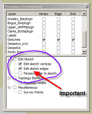
1. Make sure you have 'snapping' on. This is a two-tiered issue. Most importantly, make sure that you have two options selected in the 'Edit sketch' window. This will ensure that your draft (sketch) lines will snap. This is particularly relevant for sketching closed features.

2. Build topology for the geolines layer. This is simple. The most basic need is to enforce the 'no dangles' rule. This will flag sites where your lines overshoot or undershoot. Undershooting lines will not build polygons. Overshooting lines are unnecessary.
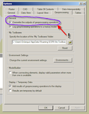
3. If you use ArcInfo, be sure to select the 'overwrite geoprocessing operations' option in the 'Options' menu. Doing this allows you to build polygons repeatedly into the same polygon layer, thus keeping only one layer and also retaining the layer's graphic attributes (i.e. colors and patterns. Note: In ArcEditor, you can only build polygons in ArcCatalog and you cannot build into an existing polygon layer as previously described.


No comments:
Post a Comment