Thursday, May 29, 2008

Hey Dummy...Quit ignoring GIS Servers in ArcCatalog

Ok. So I am not so smart...big surprise. It is digital geoscience for dummies after all, and I am a geologist, not a GIS-geek. At the DMT meeting last week I was able to have several head-to-heads with some well-trained ESRI representatives. I learned more than I can remember now, but the key thing I learned is the value of the network connection/ gis server function in ArcCatalog. Yes, I have always seen it and always ignored it. Whoops. With recent developments at ArcGIS online, you can link your mxd to various streaming sources of data. If you use ArcGIS, you need to check out ArcGIS online.

I started to get a whiff of this when using Topofusion (see previous posts) and, more recently, Global Mapper, because these programs can load imagery in the background of your project when you are online. Anyway, check this out:
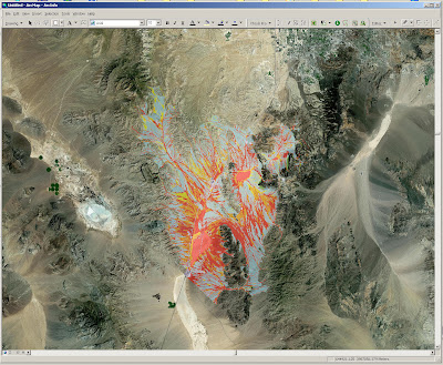

The image above shows my Ivanpah Valley, NV megamap (the flood hazard version) at 1:250k with high resolution ortho imagery in the background. Also, check this out:
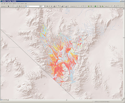

ESRI provides a decent data set of shaded relief for the globe. This is what southern Nevada looks like. The shaded relief looks considerably better when zoomed out over a larger region and makes a great overview map.

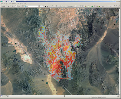
You can also 'be served' some pretty decent satellite imagery, as shown below:

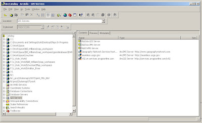
So, how does this work? Pretty freaking simple. Create Network Connections in ArcCatalog. You just need to decide if it is an ArcGIS server, an ArcIMS server, or an WMS server. Then you simple add the server data source to your active project much as you would imagery or data hosted on your desktop computer. Of potentially great interest is the fact that you can connect to seamless.usgs.gov and choose the data type that you want to add from a long list.

Note: The high resolution imagery available at ArcGIS online is the new color NAIP orthoimagery (I'm pretty sure), so it is completely viable as a geologic mapping supplement. I wish I had known about this long ago. Being self-taught in GIS has its disadvantages. If any of the 4 people out there who may look at this blog know of any other online map services of value to geologists, let me know.

Thursday, May 22, 2008

Digital Mapping Techniques Meeting Post-Mortem

I attended the USGS-AASG sponsored 'DMT' meeting for the first time this year. I should have been attending this meeting for the last several years. This year, it was in Moscow, Idaho. I applied too late to give a talk, but forced myself on the audience anyway under the guise of a discussion.

Principal Take Home Messages (through the cynical filter of DrJerque):

1. Paper maps aren't dead, but they are dying, albeit slowly.
2. ESRI is coming to terms with the power and sway of Google Earth and kml
3. Existing USGS 24 k basemaps are no longer loved by all (and hated by some)
4. LiDAR kicks proverbial butt.
5. Some geologists still use Garmin 12xl GPS units....ouch!
6. Geotagging digital photos is still news to some.
7. Geologists are generally uninterested in carting computers around in the field.
8. Many state surveys still publish maps using graphic arts programs.
9. Archiving digital data is a major concern.
10. Geologic data standards are emerging. They need to be adopted.