
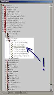
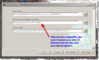
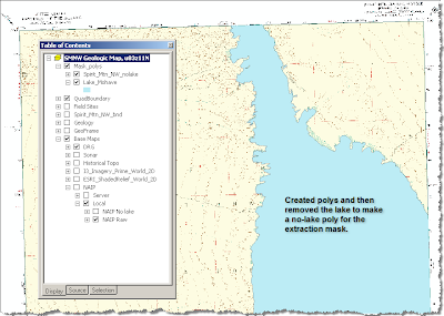
Now that you are back up to speed, I will share a simple trick I figured out by brute force that eliminates areas that may skew your stretch in an inconvenient way. Namely, large bodies of water. Right now, I am supposed to be finalizing mapping in the Spirit Mtn NW quad which includes parts of Nevada, Arizona, and Lake Mohave. Mapping along the lakeshore in the field is a joy; whereas compiling along the lakeshore is a pain in the neck...particularly when you use the standard deviation stretch restricted to the 'current display extent' which is usually the best option for contrast enhancement. The problem is caused by the black hole of lake pixels that dominate the statistics. The solution? Mask out the lake in a new raster using the 'extract' tool:
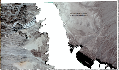
Here are the results from my current map area:
Before:
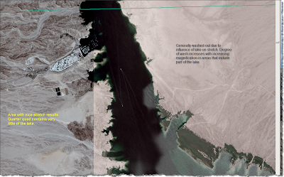
After:
Epilogue. Someone with considerably more knowledge in GIS than I once explained to me how I could do this with raster math. I screwed around with that and failed. After numerous scans through Arc Toolbox (haven't you scanned that stuff over and over looking for something?), I finally found some commands that sounded useful. Remember, this is digital geoscience for dummies.
No comments:
Post a Comment